

Horicon Motus Flyways
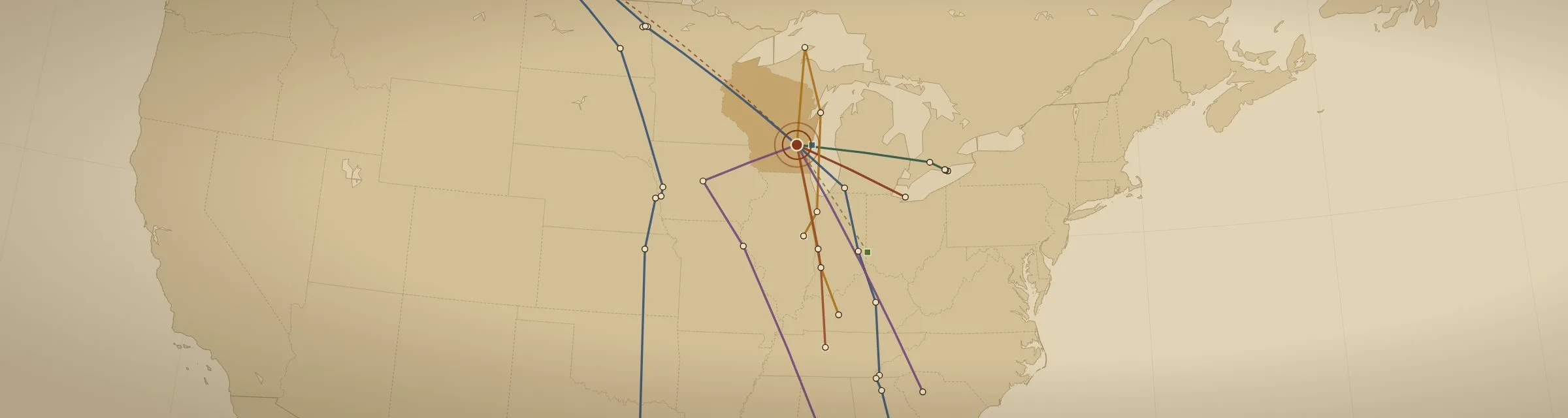
High above Horicon Marsh, a radio tower listens around the clock for tagged birds, bats and insects passing overhead. Every time one of these animals flies within range of a Motus tower, anywhere from Chile to Canada, the visit is recorded. This Horicon Marsh bird map follows every tagged animal the Horicon tower has heard, and it updates every morning at 8 a.m.
Explore the Horicon Marsh bird map
This Horicon Marsh bird map is my own geospatial interpretation of the publicly available Motus data. It is not an official product of Motus, Birds Canada or the U.S. Fish and Wildlife Service.
A listening line across Wisconsin
The U.S. Fish and Wildlife Service has added Motus receiver stations at the Horicon National Wildlife Refuge as part of a wider, coordinated effort to build east-to-west lines of towers across Wisconsin. Together they act as an invisible fence: any tagged bird, bat or large insect that crosses the state on migration has a good chance of being heard by at least one of them.
Motus itself is a global collaboration led by Birds Canada. It fills a gap that traditional bird banding leaves open. A band only tells us something when the bird is caught again or found, while a Motus tag reports the animal’s movements as it travels.
How the technology works
15–20 km range · about 9–12 miles
The towers
Each Motus station uses directional antennas tuned to the tag frequencies. When a tagged animal passes within range, the station logs its coded signal, the time and the antenna that heard it, with no one on site.
As light as 0.2 grams
The nanotags
Researchers fit animals with tiny, digitally coded radio transmitters. The smallest weigh about a fifth of a gram, light enough for songbirds, monarch butterflies and dragonflies to carry without changing how they fly or survive.
Uploaded daily
The data
Older receivers stored detections on memory cards that someone had to collect. Stations like Horicon’s send their detections over cellular networks, so researchers anywhere can follow flight paths, travel speeds and how long an animal rests at each stop.
Why Horicon Marsh matters
Horicon Marsh is one of the largest freshwater cattail marshes in the United States and a major resting and feeding stop for migrating birds. Two public lands share it: the northern two-thirds is the Horicon National Wildlife Refuge, run by the U.S. Fish and Wildlife Service, and the southern third is the Horicon Marsh State Wildlife Area, managed by the Wisconsin Department of Natural Resources. Birds move freely across both, and a Motus tower overlooking the marsh hears them wherever they land. It helps the Fish and Wildlife Service, the DNR and their partners answer questions that were out of reach before.
Following species in decline
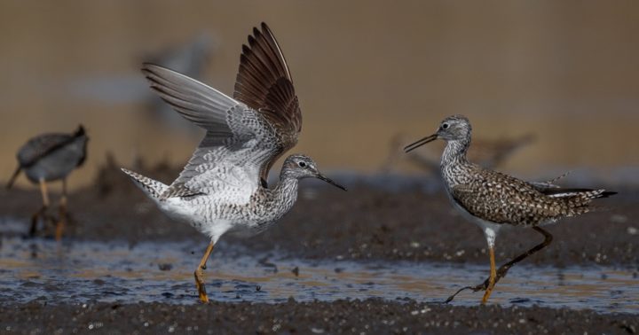
The Lesser Yellowlegs, a slender shorebird of marsh edges and mudflats, has lost an estimated 60–80% of its population in the last 50 years. It is listed as Vulnerable worldwide, Threatened in Canada and a species of conservation concern in the United States. In July 2026 the Horicon tower heard one tagged in southern Chile that March, on its way south after a spring trip to Saskatchewan. It was next heard in Puerto Rico. Records like this show scientists which wetlands these birds depend on and where they are being lost.
The whole year, not one season
Detections at Horicon join records from thousands of Motus stations worldwide. Together they trace an animal’s route from its northern breeding grounds to its wintering habitat in the southern United States or Latin America, which is what full annual cycle conservation needs.
Learn more
- Motus Wildlife Tracking SystemThe international network of stations and tagging projects.
- How Motus worksTags, stations and how the data flows, from Motus itself.
- Horicon station on the Motus dashboardThe official station page, with detections and antenna details.
- Birds Canada: the Motus programMotus is run by Birds Canada, a non-profit bird conservation group.
- Birds CanadaBird science, citizen-science programs and ways to support the work.
- Horicon National Wildlife RefugeVisiting the refuge, trails and wildlife, from the U.S. Fish and Wildlife Service.
- Horicon Marsh State Wildlife AreaThe state-managed southern third of the marsh, from the Wisconsin DNR.
- Horicon Marsh ToursGuided boat tours from Blue Heron Landing in Horicon, the best way to see the marsh and its birds up close.
- Horicon Marsh Bird ClubLocal birders sharing sightings, field trips and programs on the marsh and beyond.
- Friends of Horicon MarshThe nonprofit that supports education, programs and the visitor center on the marsh.
- Friends of Horicon National Wildlife RefugeVolunteers who support the refuge through events, education and habitat projects.
Beyond the Horicon Marsh bird map: more One Shot at History maps
This map is one of several GIS projects I’ve built to show the history and landscape of our area. You can find the others on the Wisconsin History Maps page.
Data: Motus Wildlife Tracking System, a program of Birds Canada, and the research projects that tagged each animal (named on the map). Detections are shown as published on the public Motus dashboard. Map and page by One Shot at History.
